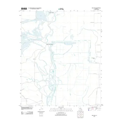
2012 Map of Fish Lake
USGS Topo · Published 2012About this map
Ouachita River meanders through this low-lying floodplain, defining a landscape dominated by intricate water systems and historic river access points. The presence of Brantley Landing, Thirteen Points Landing, and Alabama Lndg indicates a long-standing reliance on the river for transport and commerce. The terrain is characterized by a complex network of secondary water bodies, including the wide expanse of Fish Lake and seasonal drainage features like Elm Slough, Deep Slough, and Hog Wallow Slough. These natural features, alongside named landforms like Potato Patch Ridge and Hog Island, suggest a region shaped by frequent flooding and shifting river channels. The road network, including names such as Indian Mound Rd and Dead Horse Rd, hints at local landmarks and historical sites that predate modern development in this corner of Union Parish.
Find a feature on this map
34 named features on this map. Tap any name to fly to it.
Don’t see what you’re looking for? This feature index may not catch every label — zoom into the map to look around manually.
Map Details
Editions of this 2012 Fish Lake Map
This is the sole edition of this map. No revisions or reprints were ever made.
Other maps of this area

1934 · Felsenthal
USGS Topo · 1:62,500

1935 · Naff
USGS Topo · 1:62,500

1935 · Haile
USGS Topo · 1:62,500

1937 · Felsenthal
USGS Topo · 1:62,500

1938 · Felsenthal
USGS Topo · 1:62,500

1939 · Felsenthal
USGS Topo · 1:62,500

1953 · Greenwood
USGS Topo · 1:250,000

1953 · El Dorado
USGS Topo · 1:250,000

1955 · Jackson
USGS Topo · 1:250,000

1955 · Shreveport
USGS Topo · 1:250,000