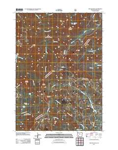
2011 Map of Fish Mountain
USGS Topo · Published 2011About this map
Fish Mountain rises as the central landmark of this drainage-rich portion of the Cascade Range in Douglas County. The landscape is defined by its complex network of cold-water streams, including Hershberger Creek, Foster Creek, and the Castle Rock Fork, which carve through the high-elevation terrain. Named peaks and ridges such as Rattlesnake Mountain and Jackass Mountain surround high-country openings like High Prairie and Pup Prairie. Small high-mountain lakes are scattered throughout the quadrangle, including Toad Lake, Triangle Lake, and Poole Lake. Notable backcountry points of interest include the Fish Creek Shelter and the curiously named Hole in the Ground near Weaver Mountain. The map detail shows the intricate system of Forest Service roads that provide access to these remote summits and the various glades and meadows, such as Alkali Meadows and Foster Glades, which have likely served as seasonal landmarks for generations of mountain travelers.
Find a feature on this map
44 named features on this map. Tap any name to fly to it.
Don’t see what you’re looking for? This feature index may not catch every label — zoom into the map to look around manually.
Map Details
Editions of this 2011 Fish Mountain Map
This is the sole edition of this map. No revisions or reprints were ever made.
Other maps of this area

1891 · Ashland
USGS Topo · 1:250,000

1893 · Ashland
USGS Topo · 1:250,000

1897 · Ashland
USGS Topo · 1:250,000

1917 · Diamond Lake
USGS Topo · 1:125,000

1944 · Abbott Butte
USGS Topo · 1:62,500

1947 · Abbott Butte
USGS Topo · 1:62,500

1955 · Quartz Mtn
USGS Topo · 1:62,500

1955 · Medford
USGS Topo · 1:250,000

1956 · Garwood Butte
USGS Topo · 1:62,500

1956 · Prospect
USGS Topo · 1:62,500