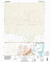
1993 Map of Fish Springs NW
USGS Topo · Published 1996About this map
The Fish Springs Range rises abruptly from the desert floor in this 1990s record of the Great Basin, where the stark transition between the Mud Flat and life-sustaining water sources defines the landscape. The Fish Springs National Wildlife Refuge occupies the southeastern corner, protecting vital wetlands like Harrison Pool and Pintail Pool that have drawn travelers and wildlife to this remote basin for centuries. Historic transportation routes are etched into the terrain, most notably the Pony Express Road which skirts the northern edge of the range near Wilson Health Springs. The northern expanse of the map is dominated by the restricted Dugway Proving Grounds, marking a sharp line between public conservation efforts and military operations. These features together show a place of environmental extremes and strategic isolation.
Find a feature on this map
14 named features on this map. Tap any name to fly to it.
Don’t see what you’re looking for? This feature index may not catch every label — zoom into the map to look around manually.
Map Details
Editions of this 1993 Fish Springs NW Map
This is the sole edition of this map. No revisions or reprints were ever made.
Other maps of this area

1908 · Fish Springs
USGS Topo · 1:250,000

1910 · Fish Springs
USGS Topo · 1:250,000

1953 · Tooele
USGS Topo · 1:250,000

1953 · Delta
USGS Topo · 1:250,000

1954 · Granite Peak SE
USGS Topo · 1:24,000

1955 · Tooele
USGS Topo · 1:250,000

1958 · Delta
USGS Topo · 1:250,000

1962 · Delta
USGS Topo · 1:250,000

1967 · Fish Springs NW
USGS Topo · 1:24,000

1967 · Fish Springs SE
USGS Topo · 1:24,000