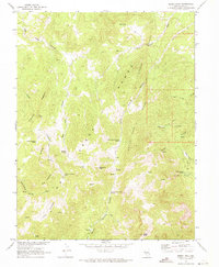
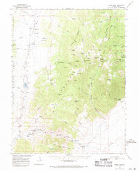
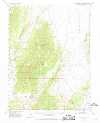
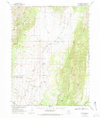
1968 Map of Fish Springs SE
USGS Topo · Published 1972About this map
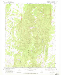
Hot Creek Range dominates this central Nevada terrain, its steep ridges and drainages surveyed in cooperation with the Atomic Energy Commission in the late 1960s. The topography drops sharply into the high desert basin of Little Fish Lake Valley, where the environment is defined by scarce water sources and intermittent washes. Small reliable points of water like Limestone Spring and Meadow Spring are critical markers in this arid landscape. To the southeast, the geography is channeled through Luther Waddles Wash, showing the natural drainage patterns that shaped regional access and grazing during this era of land management. This map serves as a detailed record of the undeveloped interior of Nye County before modern infrastructure changes.
Find a feature on this map
11 named features on this map. Tap any name to fly to it.
Don’t see what you’re looking for? This feature index may not catch every label — zoom into the map to look around manually.
Map Details
Editions of this 1968 Fish Springs SE Map
This is the sole edition of this map. No revisions or reprints were ever made.
Other maps of this area

1956 · Tonopah
USGS Topo · 1:250,000

1959 · Tonopah
USGS Topo · 1:250,000

1962 · Tonopah
USGS Topo · 1:250,000
1967 · Moores Station
USGS Topo · 1:62,500
1967 · Upper Fish Lake
USGS Topo · 1:24,000
1967 · Moores Station
USGS Topo · 1:24,000
1967 · Morey Peak
USGS Topo · 1:24,000
1968 · Morey Peak
USGS Topo · 1:62,500
1968 · Pritchards Station
USGS Topo · 1:62,500
1968 · Fish Springs
USGS Topo · 1:62,500