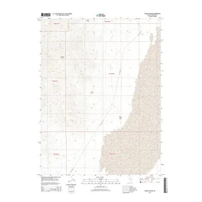
2014 Map of Fisher Canyon
USGS Topo · Published 2014About this map
Old Emigrant Rd traces a long north-south path through this portion of Pershing County, marking a historic route through the Great Basin landscape. To the west, the steep elevations of the Humboldt Range dominate the horizon, where deeply incised drainages like Fisher Canyon and Cow Canyon cut through the mountain slopes. These canyons open onto the expansive floor of the Buena Vista Valley, a wide alluvial basin that occupies the eastern half of the sheet.
Find a feature on this map
12 named features on this map. Tap any name to fly to it.
Don’t see what you’re looking for? This feature index may not catch every label — zoom into the map to look around manually.
Map Details
Editions of this 2014 Fisher Canyon Map
This is the sole edition of this map. No revisions or reprints were ever made.
Other maps of this area

1931 · Lovelock
USGS Topo · 1:250,000

1932 · Sonoma Range
USGS Topo · 1:250,000

1935 · Lovelock
USGS Topo · 1:250,000

1939 · Sonoma Range
USGS Topo · 1:250,000

1954 · Unionville
USGS Topo · 1:62,500

1954 · Buffalo Mtn
USGS Topo · 1:62,500

1955 · Lovelock
USGS Topo · 1:250,000

1955 · Winnemucca
USGS Topo · 1:250,000

1958 · Winnemucca
USGS Topo · 1:250,000

1959 · Lovelock
USGS Topo · 1:250,000