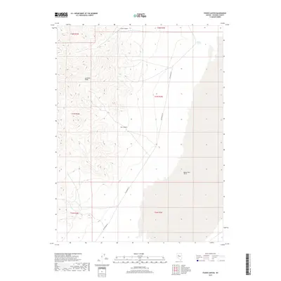
2018 Map of Fisher Canyon
USGS Topo · Published 2018About this map
The Humboldt Range dominates the western topography of this Pershing County landscape, where steep slopes descend into the expansive Buena Vista Valley to the east. Historically significant transport routes are preserved in the mapping of the Old Emigrant Rd, which skirts the base of the mountains, tracing a path that long preceded modern infrastructure. Water sources in this arid environment are sparse but critical, marked by the presence of Buffalo Springs in the northeastern section. Drainage patterns are defined by the rugged cuts of Fisher Canyon and Cow Canyon, which funnel seasonal runoff from the high peaks toward the valley floor. The map provides a clear look at the Public Land Survey System grid, illustrating the township and range divisions that governed Nevada's land distribution and mining claims during the late twentieth and early twenty-first centuries.
Find a feature on this map
12 named features on this map. Tap any name to fly to it.
Don’t see what you’re looking for? This feature index may not catch every label — zoom into the map to look around manually.
Map Details
Editions of this 2018 Fisher Canyon Map
This is the sole edition of this map. No revisions or reprints were ever made.
Other maps of this area

1931 · Lovelock
USGS Topo · 1:250,000

1932 · Sonoma Range
USGS Topo · 1:250,000

1935 · Lovelock
USGS Topo · 1:250,000

1939 · Sonoma Range
USGS Topo · 1:250,000

1954 · Unionville
USGS Topo · 1:62,500

1954 · Buffalo Mtn
USGS Topo · 1:62,500

1955 · Lovelock
USGS Topo · 1:250,000

1955 · Winnemucca
USGS Topo · 1:250,000

1958 · Winnemucca
USGS Topo · 1:250,000

1959 · Lovelock
USGS Topo · 1:250,000