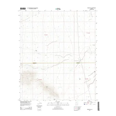
2014 Map of Fisher Hills
USGS Topo · Published 2014About this map
Fisher Hills dominates the southern landscape of this high-desert region, where the county line between Graham and Cochise counties cuts horizontally through the topography. This 2014 survey captures a transition zone defined by seasonal water drainage and intermittent catchments, most notably the Creighton Reservoir located just east of the primary hills. The terrain is marked by a network of dry washes and draws that dictate the local movement of water and livestock across the arid plains. Features such as Dial Wash, Willow Spring Wash, and Timber Draw highlight the natural drainage patterns, while the presence of Gold Gulch suggests the historical prospecting and ranching heritage of the Arizona borderlands. This map serves as a record of the intricate land surveying system, detailing the township and range lines that segment this vast, open territory.
Find a feature on this map
12 named features on this map. Tap any name to fly to it.
Don’t see what you’re looking for? This feature index may not catch every label — zoom into the map to look around manually.
Map Details
Editions of this 2014 Fisher Hills Map
This is the sole edition of this map. No revisions or reprints were ever made.
Other maps of this area

1917 · San Simon
USGS Topo · 1:125,000

1922 · Willcox
USGS Topo · 1:125,000

1928 · Bowie
USGS Topo · 1:62,500

1944 · Fisher Hills
USGS Topo · 1:62,500

1949 · Bowie
USGS Topo · 1:62,500

1950 · Bowie
USGS Topo · 1:62,500

1954 · Silver City
USGS Topo · 1:250,000

1957 · Luzena
USGS Topo · 1:62,500

1958 · Silver City
USGS Topo · 1:250,000

1962 · Silver City
USGS Topo · 1:250,000