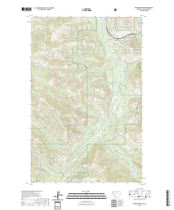
2024 Map of Fisher Mountain
USGS Topo · Published 2024About this map
The Cabinet Mountains dominate this high-elevation corner of the Kootenai National Forest, where steep drainages and mountain summits define the geography. The terrain is centered on Fisher Mtn and Lightning Peak, with the Fisher River flowing northward through the valley floor. The map highlights a complex network of forest development roads, such as Natl Forest Develop Road 862 RD and Natl Forest Develop Road 764 RD, which provide the primary access to these remote reaches. Numerous tributary streams including Wolf Creek, Pecolet Creek, and Harris Creek carve deep into the mountain slopes, illustrating the rugged hydrological system of the region. This 2024 survey documents the modern management of public lands and the persisting natural character of Lincoln County's high country.
Find a feature on this map
33 named features on this map. Tap any name to fly to it.
Don’t see what you’re looking for? This feature index may not catch every label — zoom into the map to look around manually.
Map Details
Editions of this 2024 Fisher Mountain Map
This is the sole edition of this map. No revisions or reprints were ever made.
Other maps of this area

1920 · Jennings
USGS Topo · 1:125,000

1935 · Thompson Lakes
USGS Topo · 1:96,000

1942 · Thompson Lakes
USGS Topo · 1:125,000

1957 · Kalispell
USGS Topo · 1:250,000

1960 · Kalispell
USGS Topo · 1:250,000

1961 · Kalispell
USGS Topo · 1:250,000

1963 · Swede Mountain
USGS Topo · 1:24,000
1963 · Tony Peak
USGS Topo · 1:24,000
1963 · Richards Mountain
USGS Topo · 1:24,000
1966 · Horse Mountain
USGS Topo · 1:24,000