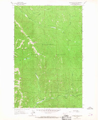
1963 Map of Richards Mountain
USGS Topo · Published 1967About this map
Kootenai National Forest dominates this 1963 study of the Lincoln County high country, revealing a landscape defined by drainage networks and narrow ridge-lines. Elevations vary significantly between prominent summits like Dunn Peak and Richards Mountain, which serve as the primary landmarks for the surrounding terrain. Human activity is sparse but specific, centered on the Barnett Ranch and a nearby Gravel Pit along the banks of Wolf Creek.
Find a feature on this map
20 named features on this map. Tap any name to fly to it.
Don’t see what you’re looking for? This feature index may not catch every label — zoom into the map to look around manually.
Map Details
Editions of this 1963 Richards Mountain Map
2 editions found
Other maps of this area

1920 · Jennings
USGS Topo · 1:125,000

1935 · Thompson Lakes
USGS Topo · 1:96,000

1942 · Thompson Lakes
USGS Topo · 1:125,000

1957 · Kalispell
USGS Topo · 1:250,000

1960 · Kalispell
USGS Topo · 1:250,000

1961 · Kalispell
USGS Topo · 1:250,000

1963 · Wolf Prairie
USGS Topo · 1:24,000

1963 · Warland Peak
USGS Topo · 1:24,000

1963 · Cripple Horse Mountain
USGS Topo · 1:24,000
1963 · Tony Peak
USGS Topo · 1:24,000