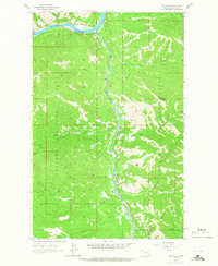
1963 Map of Tony Peak
USGS Topo · Published 1966About this map
The Kootenai River carves a sharp turn at Big Bend in this corner of the Kootenai National Forest, where the Fisher River flows north to meet the main channel. At this time in the early 1960s, the Great Northern railroad tracks follow the southern bank of the Kootenai, providing the primary transportation corridor through this mountain landscape. High above the river valleys, the terrain is defined by peaks like Tony Peak, which is topped by a Lookout Tower, and Riverview Mountain to the east.
Find a feature on this map
22 named features on this map. Tap any name to fly to it.
Don’t see what you’re looking for? This feature index may not catch every label — zoom into the map to look around manually.
Map Details
Editions of this 1963 Tony Peak Map
2 editions found
Other maps of this area

1920 · Jennings
USGS Topo · 1:125,000

1935 · Thompson Lakes
USGS Topo · 1:96,000

1942 · Thompson Lakes
USGS Topo · 1:125,000

1957 · Kalispell
USGS Topo · 1:250,000

1960 · Kalispell
USGS Topo · 1:250,000

1961 · Kalispell
USGS Topo · 1:250,000

1963 · Vermiculite Mountain
USGS Topo · 1:24,000

1963 · Swede Mountain
USGS Topo · 1:24,000

1963 · Cripple Horse Mountain
USGS Topo · 1:24,000
1963 · Alexander Mountain
USGS Topo · 1:24,000