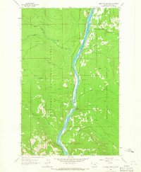
1963 Map of Alexander Mountain
USGS Topo · Published 1966About this map
The Kootenai River carves a deep valley through the Kootenai National Forest in this 1963 survey, where the Great Northern railroad tracks trace the eastern shoreline. The small settlements of Warland and Yarnell occupy narrow benches of land along the river, positioned between the water and the rising terrain of Gopher Hill and Alexander Mountain. This specific era captures the landscape before significant modern changes, documenting the intricate system of drainages such as Cripple Horse Creek and Warland Creek that feed into the main river channel.
Find a feature on this map
28 named features on this map. Tap any name to fly to it.
Don’t see what you’re looking for? This feature index may not catch every label — zoom into the map to look around manually.
Map Details
Editions of this 1963 Alexander Mountain Map
2 editions found
Other maps of this area

1920 · Jennings
USGS Topo · 1:125,000

1935 · Thompson Lakes
USGS Topo · 1:96,000

1942 · Thompson Lakes
USGS Topo · 1:125,000

1957 · Kalispell
USGS Topo · 1:250,000

1960 · Kalispell
USGS Topo · 1:250,000

1961 · Kalispell
USGS Topo · 1:250,000

1963 · Vermiculite Mountain
USGS Topo · 1:24,000

1963 · Swede Mountain
USGS Topo · 1:24,000

1963 · Banfield Mountain
USGS Topo · 1:24,000

1963 · Cripple Horse Mountain
USGS Topo · 1:24,000