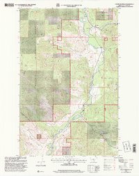
1997 Map of Fisher Mountain
USGS Topo · Published 2000About this map
Fisher River carves a deep valley through this portion of the Kootenai National Forest during the late 1990s. The landscape is defined by its industrial and topographic landmarks, notably the Fisher River Siding and a nearby Gravel Pit along the river's eastern banks. High points like Fisher Mountain and Lightning Peak overlook a complex network of drainage basins, including Wolf Creek, Cow Creek, and Snell Creek.
Find a feature on this map
22 named features on this map. Tap any name to fly to it.
Don’t see what you’re looking for? This feature index may not catch every label — zoom into the map to look around manually.
Map Details
Editions of this 1997 Fisher Mountain Map
This is the sole edition of this map. No revisions or reprints were ever made.
Other maps of this area

1920 · Jennings
USGS Topo · 1:125,000

1935 · Thompson Lakes
USGS Topo · 1:96,000

1942 · Thompson Lakes
USGS Topo · 1:125,000

1957 · Kalispell
USGS Topo · 1:250,000

1960 · Kalispell
USGS Topo · 1:250,000

1961 · Kalispell
USGS Topo · 1:250,000

1963 · Swede Mountain
USGS Topo · 1:24,000
1963 · Tony Peak
USGS Topo · 1:24,000
1963 · Richards Mountain
USGS Topo · 1:24,000
1966 · Horse Mountain
USGS Topo · 1:24,000