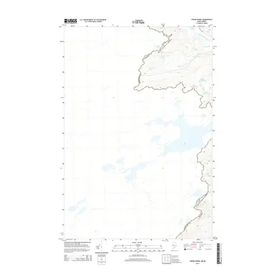
2014 Map of Fisher Ponds
USGS Topo · Published 2014About this map
The international border between Maine and Quebec cuts a jagged path through this remote landscape in Somerset County. Centered on the high-elevation wetlands of the North Woods, the map documents a complex drainage system where Fisher Ponds and Lac Wilson sit just south of the Canadian line. The terrain is defined by its glacial hydrology, featuring a string of small water bodies including Middle Grenier Pond, Little Grenier Pond, and Upper Dingley Pond. Infrastructure is nearly non-existent in this timber-country interior, with Pole Pond Rd providing the only named terrestrial access in the northeast corner near Frost Pond. The detailed topography illustrates the height of land that separates the watersheds, where Stony Brook and the Frost Pond Flowage navigate the winding valleys of the border region.
Find a feature on this map
11 named features on this map. Tap any name to fly to it.
Don’t see what you’re looking for? This feature index may not catch every label — zoom into the map to look around manually.
Map Details
Editions of this 2014 Fisher Ponds Map
This is the sole edition of this map. No revisions or reprints were ever made.
Other maps of this area

1927 · Sandy Bay
USGS Topo · 1:48,000

1930 · Sandy Bay
USGS Topo · 1:62,500

1944 · Sandy Bay
USGS Topo · 1:62,500

1949 · Jackman
USGS Topo · 1:250,000

1956 · Penobscot Lake
USGS Topo · 1:62,500

1957 · Norris Brook
USGS Topo · 1:62,500

1957 · Saint Zacharie
USGS Topo · 1:62,500

1962 · Quebec
USGS Topo · 1:250,000

1963 · Jackman
USGS Topo · 1:250,000

1966 · Sherbrooke
USGS Topo · 1:250,000