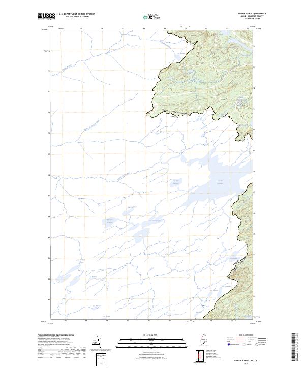
2024 Map of Fisher Ponds
USGS Topo · Published 2024About this map
The international boundary between the United States and Canada defines the rugged topography of this Somerset County border region. This landscape is characterized by an intricate network of remote glacial lakes and waterways, with the Fisher Ponds and Frost Pond situated near the heights of the northern border. The naming conventions across the terrain reflect a blend of English and French heritage, seen in water bodies such as Lac du Portage and Stony Brook. Significant drainage systems like the Rivière Wilson and Rivière du Portage carve through the forested interior, connecting a series of smaller ponds including Lac Coburn, Lac des Cygnes, and Lac Champagne. The map details a wilderness environment where the lack of established roads highlights the area's isolation along the Maine-Quebec frontier, preserved here in its early twenty-first-century state.
Find a feature on this map
26 named features on this map. Tap any name to fly to it.
Don’t see what you’re looking for? This feature index may not catch every label — zoom into the map to look around manually.
Map Details
Editions of this 2024 Fisher Ponds Map
This is the sole edition of this map. No revisions or reprints were ever made.
Other maps of this area

1927 · Sandy Bay
USGS Topo · 1:48,000

1930 · Sandy Bay
USGS Topo · 1:62,500

1944 · Sandy Bay
USGS Topo · 1:62,500

1949 · Jackman
USGS Topo · 1:250,000

1956 · Penobscot Lake
USGS Topo · 1:62,500

1957 · Norris Brook
USGS Topo · 1:62,500

1957 · Saint Zacharie
USGS Topo · 1:62,500

1962 · Quebec
USGS Topo · 1:250,000

1963 · Jackman
USGS Topo · 1:250,000

1966 · Sherbrooke
USGS Topo · 1:250,000