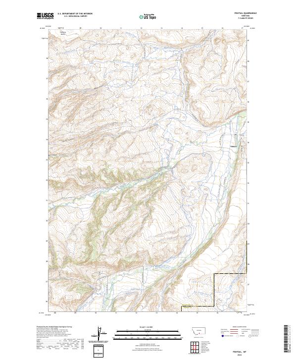
2024 Map of Fishtail
USGS Topo · Published 2024About this map
Fishtail serves as the primary settlement hub in this part of Stillwater and Carbon Counties, characterized by a complex network of agricultural irrigation and rugged canyon topography. The landscape is defined by its water management history, with numerous named waterways such as Magee Ditch, Yates Ditch, and Nels Thomas Ditch drawing from the perennial flows of West Rosebud Creek and Fishtail Creek. Prominent geological features like the Fladberg Bench to the north and the sharp relief of Murphy Canyon and Box Canyon illustrate the transition from high plateaus to the drainage basins below. Local landmarks such as Mystic View and the geological formation of Nellies Twin Buttes provide specific points of interest for those tracing the terrain between Davidson Creek and Antelope Creek.
Find a feature on this map
44 named features on this map. Tap any name to fly to it.
Don’t see what you’re looking for? This feature index may not catch every label — zoom into the map to look around manually.
Map Details
Editions of this 2024 Fishtail Map
This is the sole edition of this map. No revisions or reprints were ever made.
Other maps of this area

1891 · Big Timber
USGS Topo · 1:125,000

1892 · Stillwater
USGS Topo · 1:125,000

1893 · Big Timber
USGS Topo · 1:125,000

1898 · Granite Mountain District
USGS Topo · 1:125,000

1932 · Red Lodge No 2
USGS Topo · 1:48,000

1932 · Nye No 1
USGS Topo · 1:48,000

1954 · Billings
USGS Topo · 1:250,000

1955 · Sandborn Creek
USGS Topo · 1:24,000

1955 · Absarokee
USGS Topo · 1:24,000
1955 · Cow Face Hill
USGS Topo · 1:24,000