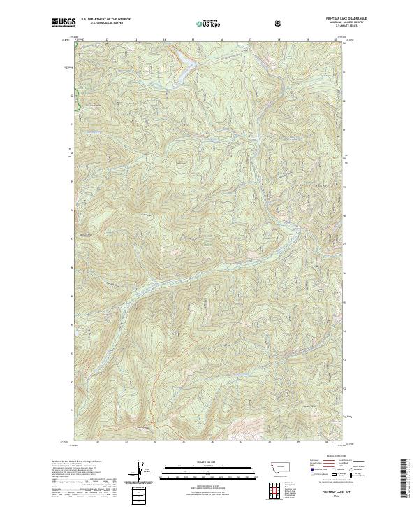
2024 Map of Fishtrap Lake
USGS Topo · Published 2024About this map
The Cabinet Mountains define this high-altitude landscape where the boundaries of the Kaniksu National Forest and Lolo National Forest meet. This montane environment is structured by a complex drainage system, including Fishtrap Creek, Radio Creek, and West Fork Fishtrap Creek. The map documents a network of named peaks and ridges that served as critical landmarks for early forest management and survey efforts. Distinctive summits like Basin Peak, Marmot Peak, and Wee Peak dominate the skyline, while specialized routes such as the Sundance Ridge Trl and Beatrice Saddle Trl provide passage through the high country. The absence of established towns highlights the area's role as a managed timber and wilderness resource, punctuated only by forest development roads like Nat For Dev Rd Rd 7593.
Find a feature on this map
36 named features on this map. Tap any name to fly to it.
Don’t see what you’re looking for? This feature index may not catch every label — zoom into the map to look around manually.
Map Details
Editions of this 2024 Fishtrap Lake Map
This is the sole edition of this map. No revisions or reprints were ever made.
Other maps of this area

1937 · Thompson Falls
USGS Topo · 1:125,000

1937 · Thompson Falls
USGS Topo · 1:62,500

1956 · Wallace
USGS Topo · 1:250,000

1957 · Thompson Falls
USGS Topo · 1:62,500

1960 · Wallace
USGS Topo · 1:250,000

1964 · Calico Creek
USGS Topo · 1:24,000
1964 · Priscilla Peak
USGS Topo · 1:24,000

1966 · Vermilion Peak
USGS Topo · 1:24,000
1966 · Bend
USGS Topo · 1:24,000
1966 · Miller Lake
USGS Topo · 1:24,000