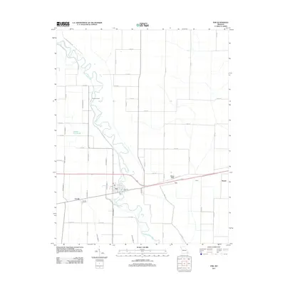
2011 Map of Fisk
USGS Topo · Published 2011About this map
The winding Saint Francis River dominates this portion of Butler County, its natural meanders contrasting with the rigid geometry of the surrounding agricultural drainage system. The settlement of Fisk serves as a local hub along the riverbanks, where the presence of the Riverside Mill and Poplin Ferry points to a historical reliance on the waterway for industry and transit. To the west, the community of Ash Hill is situated near the Ash Hills Cemetery, while further north, Owens Cemetery sits along a quiet bend in the river. This landscape is defined by its water management history, featuring an extensive network of numbered channels including Ditch Number 11 and Ditch Number 17 that drain the low-lying plains near Panther Run Slough. Smaller residential clusters like Green Oaks, Ives, and Poplin line the modern thoroughfares, marking the evolution of this rural river valley.
Find a feature on this map
51 named features on this map. Tap any name to fly to it.
Don’t see what you’re looking for? This feature index may not catch every label — zoom into the map to look around manually.
Map Details
Editions of this 2011 Fisk Map
This is the sole edition of this map. No revisions or reprints were ever made.
Other maps of this area

1934 · Puxico
USGS Topo · 1:62,500

1935 · Poplar Bluff
USGS Topo · 1:62,500

1935 · Harviell
USGS Topo · 1:62,500

1939 · Puxico
USGS Topo · 1:62,500

1939 · Poplar Bluff
USGS Topo · 1:62,500

1940 · Valley Ridge
USGS Topo · 1:62,500

1949 · Poplar Bluff
USGS Topo · 1:62,500

1956 · Valley Ridge
USGS Topo · 1:62,500

1957 · Poplar Bluff
USGS Topo · 1:250,000

1959 · Poplar Bluff
USGS Topo · 1:250,000