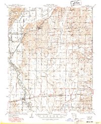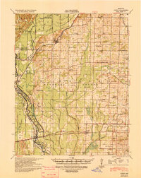
1939 Map of Puxico
USGS Topo · Published 1942About this map
The St Louis - San Francisco Ry and the Missouri Pacific RR define the settlement patterns of this Missouri landscape, connecting towns like Puxico and Dudley. This region is a complex network of man-made drainage, evidenced by numbered channels such as Ditch No 4 and Ditch No 11 that crisscross the lowlands of The Glades Swamp. The tension between natural wetlands and agricultural expansion is clear, with the Mingo National Wildlife Refuge and Rockhouse Cypress preserving portions of the original bottomland habitat.
Find a feature on this map
92 named features on this map. Tap any name to fly to it.
Don’t see what you’re looking for? This feature index may not catch every label — zoom into the map to look around manually.
Map Details
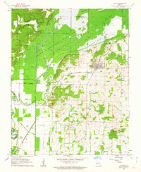
Editions of this 1939 Puxico Map
This is the sole edition of this map. No revisions or reprints were ever made.
Historical Maps of Puxico Through Time
7 maps found