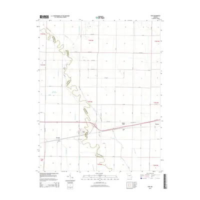
2015 Map of Fisk
USGS Topo · Published 2015About this map
The Saint Francis River meanders along the boundary of Butler and Stoddard counties, anchoring a landscape defined by an intricate network of drainage engineering. This 2015 survey highlights the sophisticated water management systems of the region, featuring named channels such as Mingo Ditch, Coal Oil Johnny Ditch, and Prairie Cr Ditch. These waterways support the agricultural character of the area surrounding the settlement of Fisk, where road networks and rail lines converge. Local history and genealogy are preserved at sites like Ash Hills Cemetery and Owens Cemetery, while smaller locales such as Ash Hill, Green Oaks, and Ives mark the intersections of rural life. The presence of Panther Run Slough suggests the original low-lying, swampy nature of this Missouri terrain before the systematic creation of numbered ditches, including Ditch Number 16 and Ditch Number 17, transformed the valley floor.
Find a feature on this map
77 named features on this map. Tap any name to fly to it.
Don’t see what you’re looking for? This feature index may not catch every label — zoom into the map to look around manually.
Map Details
Editions of this 2015 Fisk Map
This is the sole edition of this map. No revisions or reprints were ever made.
Other maps of this area

1934 · Puxico
USGS Topo · 1:62,500

1935 · Poplar Bluff
USGS Topo · 1:62,500

1935 · Harviell
USGS Topo · 1:62,500

1939 · Puxico
USGS Topo · 1:62,500

1939 · Poplar Bluff
USGS Topo · 1:62,500

1940 · Valley Ridge
USGS Topo · 1:62,500

1949 · Poplar Bluff
USGS Topo · 1:62,500

1956 · Valley Ridge
USGS Topo · 1:62,500

1957 · Poplar Bluff
USGS Topo · 1:250,000

1959 · Poplar Bluff
USGS Topo · 1:250,000