2021 Map of Fisk
USGS Topo · Published 2021About this map
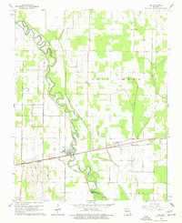
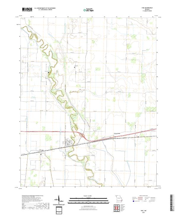
The Saint Francis River meanders heavily across the center of this quadrangle, forming a natural boundary between Butler and Stoddard counties. The landscape is defined by an extensive network of drainage infrastructure, including the Mingo Ditch, Coal Oil Johnny Ditch, and Prairie Cr Ditch, which reflects the region's history of reclaiming wetlands for agriculture. The town of Fisk serves as a primary hub, situated near the river crossing, while smaller named locales such as Ash Hill, Ives, and Green Oaks dot the surrounding area.
Find a feature on this map
68 named features on this map. Tap any name to fly to it.
Don’t see what you’re looking for? This feature index may not catch every label — zoom into the map to look around manually.
Map Details
Editions of this 2021 Fisk Map
This is the sole edition of this map. No revisions or reprints were ever made.