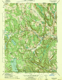
1943 Map of Fitchville
USGS Topo · Published 1943About this map
Fitchville and Bozrah Street anchor this wartime survey of the rural Connecticut interior during the early 1940s. The landscape is defined by the winding Yantic River and a dense network of brooks like Pease Brook and Susquetonscut Brook that carved the hilly terrain of Bozrah and Franklin. The Central Vermont Railroad cuts through the northeast, passing Franklin Sta, while the Norwich Colchester Turnpike provides a primary automotive artery through Gilman.
Find a feature on this map
77 named features on this map. Tap any name to fly to it.
Don’t see what you’re looking for? This feature index may not catch every label — zoom into the map to look around manually.
Map Details
Editions of this 1943 Fitchville Map
3 editions found
Other maps of this area

1892 · New London
USGS Topo · 1:62,500

1892 · Norwich
USGS Topo · 1:62,500

1892 · Gilead
USGS Topo · 1:62,500

1893 · New London
USGS Topo · 1:62,500

1893 · Saybrook
USGS Topo · 1:62,500

1921 · New London
USGS Topo · 1:62,500

1935 · Montville
USGS Topo · 1:24,000

1939 · Montville
USGS Topo · 1:31,680
1941 · Uncasville
USGS Topo · 1:31,680

1943 · Fitchville
USGS Topo · 1:31,680