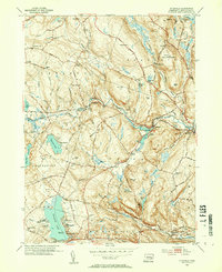
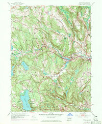
1953 Map of Fitchville
USGS Topo · Published 1955About this map
The Yantic River carves a distinctive path through this mid-century landscape, powering the small industrial pockets of Gilman and Fitchville. This 1953 revision reveals a region defined by its numerous summer camps and recreational waters, particularly around Gardner Lake, which is home to Camp Winnipew, Camp Wetonawe, and Minnie Island. The presence of the Central Vermont railroad line and the Jonathan Trumbull Highway highlights the era's evolving transportation network, connecting the rural uplands of Lebanon and Bozrah.
Find a feature on this map
96 named features on this map. Tap any name to fly to it.
Don’t see what you’re looking for? This feature index may not catch every label — zoom into the map to look around manually.
Map Details
Editions of this 1953 Fitchville Map
5 editions found
Other maps of this area

1892 · New London
USGS Topo · 1:62,500

1892 · Norwich
USGS Topo · 1:62,500

1892 · Gilead
USGS Topo · 1:62,500

1893 · New London
USGS Topo · 1:62,500

1893 · Saybrook
USGS Topo · 1:62,500

1921 · New London
USGS Topo · 1:62,500

1935 · Montville
USGS Topo · 1:24,000

1939 · Montville
USGS Topo · 1:31,680
1941 · Uncasville
USGS Topo · 1:31,680

1943 · Fitchville
USGS Topo · 1:31,680