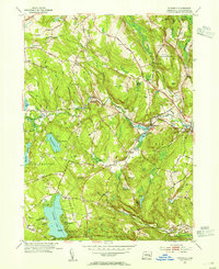
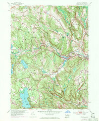
1953 Map of Fitchville
USGS Topo · Published 1955About this map
The Yantic River meanders through the heart of New London County, defining the industrial and social development of settlements like Gilman and Fitchville. This 1950s revision illustrates a landscape where traditional New England agriculture and early 20th-century recreational culture intersect. Large water bodies such as Gardner Lake and Deep River Reservoir dominate the southern and western portions of the sheet, providing the setting for numerous summer camps including Camp Mooween and Camp Winapew.
Find a feature on this map
70 named features on this map. Tap any name to fly to it.
Don’t see what you’re looking for? This feature index may not catch every label — zoom into the map to look around manually.
Map Details
Editions of this 1953 Fitchville Map
5 editions found
Other maps of this area

1892 · New London
USGS Topo · 1:62,500

1892 · Norwich
USGS Topo · 1:62,500

1892 · Gilead
USGS Topo · 1:62,500

1893 · New London
USGS Topo · 1:62,500

1893 · Saybrook
USGS Topo · 1:62,500

1921 · New London
USGS Topo · 1:62,500

1935 · Montville
USGS Topo · 1:24,000

1939 · Montville
USGS Topo · 1:31,680
1941 · Uncasville
USGS Topo · 1:31,680

1943 · Fitchville
USGS Topo · 1:31,680