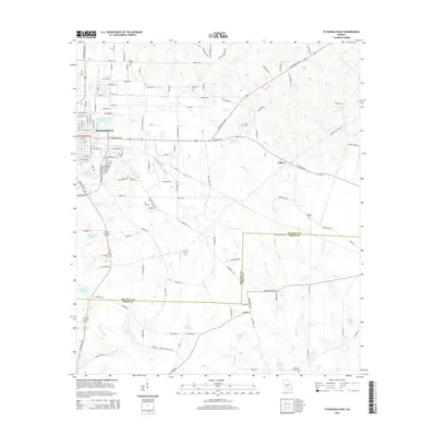
2014 Map of Fitzgerald East
USGS Topo · Published 2014About this map
Fitzgerald anchors the western edge of this South Georgia landscape, where the municipal limits transition into the agricultural fields and pine lands along the Ben Hill and Irwin County line. The terrain is defined by the headwaters and drainage basins of several significant watercourses, including the southward-flowing Satilla Cr and Willa-coochee Cr. The density of family and community burial grounds, such as Kiokee Cem, Evergreen Cem, and Mc Cook Cem, points to a well-established rural settlement pattern that predates the modern road network. A small cluster of activity at Ashton sits at the intersection of the Jacksonville Hwy and Broxton Hwy, serving as a local waypoint east of the city. Numerous ponds and lakes, from Dorminy Lake to the more remote Hopkins Lake, highlight the importance of local water resources in this coastal plain environment.
Find a feature on this map
120 named features on this map. Tap any name to fly to it.
Don’t see what you’re looking for? This feature index may not catch every label — zoom into the map to look around manually.
Map Details
Editions of this 2014 Fitzgerald East Map
This is the sole edition of this map. No revisions or reprints were ever made.
Other maps of this area

1953 · Waycross
USGS Topo · 1:250,000

1958 · Waycross
USGS Topo · 1:250,000

1972 · Fitzgerald East
USGS Topo · 1:24,000

1972 · Ambrose
USGS Topo · 1:24,000

1972 · China Hill
USGS Topo · 1:24,000

1972 · Ocilla East
USGS Topo · 1:24,000

1972 · Queensland
USGS Topo · 1:24,000

1973 · Ocilla West
USGS Topo · 1:24,000

1973 · Fitzgerald West
USGS Topo · 1:24,000

1977 · Osierfield
USGS Topo · 1:24,000