2024 Map of Fitzpatrick
USGS Topo · Published 2024About this map
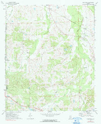
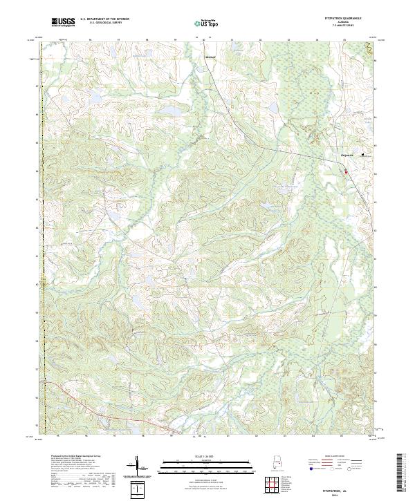
Fitzpatrick and Mitchell anchor this portion of Bullock County, reflecting a landscape defined by the drainage patterns of Panther Creek and Pinhook Creek. The area is densely dotted with man-made water features and agricultural reservoirs, including Lake Forrer Number One, Lake Forrer Number Two, and Tompkins Lake. The settlement of Fitzpatrick remains a focal point for local history researchers, specifically centered around the Fitzpatrick Cem and its proximity to the rural road network like Bullock Co 185.
Find a feature on this map
40 named features on this map. Tap any name to fly to it.
Don’t see what you’re looking for? This feature index may not catch every label — zoom into the map to look around manually.
Map Details
Editions of this 2024 Fitzpatrick Map
This is the sole edition of this map. No revisions or reprints were ever made.