
1971 Map of Hardaway
USGS Topo · Published 1974About this map
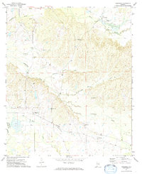
Cubahatchee Creek and its many tributaries, including Beaverdam Creek and Sleepy Creek, dominate this part of Macon County. The landscape is defined by the Seaboard Coast Line railroad, which links the small communities of Hardaway and Downs. This area shows a dense network of local landmarks vital for genealogical research, with numerous rural congregations such as Damascus Ch, Beulah Ch, and Union Oak Grove Ch scattered across the creek valleys. Near the northern edge, the settlement of La Place sits alongside family-named sites like Cole Cem. The transition into Bullock County at the southwestern corner is marked by Bagnall Cr, reflecting a mid-century rural Alabama economy still closely tied to the watercourses and rail lines that supported these historic crossroads.
Find a feature on this map
24 named features on this map. Tap any name to fly to it.
Don’t see what you’re looking for? This feature index may not catch every label — zoom into the map to look around manually.
Map Details
Editions of this 1971 Hardaway Map
2 editions found
Other maps of this area

1955 · Phenix City
USGS Topo · 1:250,000

1957 · Phenix City
USGS Topo · 1:250,000

1958 · Phenix City
USGS Topo · 1:250,000

1971 · Tuskegee
USGS Topo · 1:24,000

1971 · Shorter
USGS Topo · 1:24,000

1971 · La Place
USGS Topo · 1:24,000

1971 · Thompson
USGS Topo · 1:24,000
1971 · Fitzpatrick
USGS Topo · 1:24,000
1971 · Chesson
USGS Topo · 1:24,000
1973 · Union Springs
USGS Topo · 1:24,000