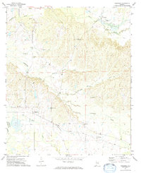
1971 Map of Hardaway
USGS Topo · Published 1974About this map
Cubahatchee Creek and its many tributaries, including Beaverdam Creek and Coon Hop Creek, define the landscape of this rural portion of the Alabama coastal plain. Small communities like Hardaway and Downs anchor the southern half of the map, connected by the Seaboard Coast Line railroad. Further north, an Old Railroad Grade indicates an evolving transportation network near Liverpool.
Find a feature on this map
27 named features on this map. Tap any name to fly to it.
Don’t see what you’re looking for? This feature index may not catch every label — zoom into the map to look around manually.
Map Details
Editions of this 1971 Hardaway Map
2 editions found
Other maps of this area

1955 · Phenix City
USGS Topo · 1:250,000

1957 · Phenix City
USGS Topo · 1:250,000

1958 · Phenix City
USGS Topo · 1:250,000

1971 · Tuskegee
USGS Topo · 1:24,000

1971 · Shorter
USGS Topo · 1:24,000

1971 · La Place
USGS Topo · 1:24,000

1971 · Hardaway
USGS Topo · 1:24,000

1971 · Thompson
USGS Topo · 1:24,000
1971 · Fitzpatrick
USGS Topo · 1:24,000
1971 · Chesson
USGS Topo · 1:24,000