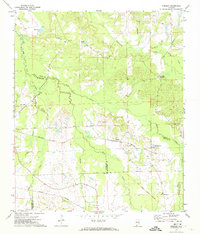
1971 Map of Chesson
USGS Topo · Published 1974About this map
Cubahatchee Creek and Old Town Creek wind through this rural Alabama landscape at the junction of Macon, Montgomery, and Bullock Counties. The area's mid-century infrastructure is defined by two major rail corridors: the Seaboard Coast Line, which serves the settlement of Chesson, and the Central of Georgia further south. A notable historical marker on the terrain is the Indian Treaty Boundary, which cuts diagonally across the southeastern corner near Allens Chapel. This rural community is anchored by numerous small houses of worship and burial sites, including Mt Zion Ch and its adjacent Mt Zion Cem, as well as Mt Silah Ch and Mathis Chapel. The map details a transition from lowland sloughs and creeks to managed ponds like Halls Pond and Spoins Lake, illustrating the local drainage patterns and land use in the early 1970s.
Find a feature on this map
31 named features on this map. Tap any name to fly to it.
Don’t see what you’re looking for? This feature index may not catch every label — zoom into the map to look around manually.
Map Details
Editions of this 1971 Chesson Map
2 editions found
Other maps of this area

1953 · Montgomery
USGS Topo · 1:250,000

1955 · Phenix City
USGS Topo · 1:250,000

1956 · Montgomery
USGS Topo · 1:250,000

1957 · Phenix City
USGS Topo · 1:250,000

1957 · Montgomery
USGS Topo · 1:250,000

1958 · Phenix City
USGS Topo · 1:250,000

1958 · Mount Meigs
USGS Topo · 1:62,500

1971 · Shorter
USGS Topo · 1:24,000

1971 · La Place
USGS Topo · 1:24,000

1971 · Hardaway
USGS Topo · 1:24,000