
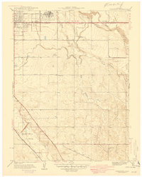
1941 Map of Fitzsimons
USGS Topo · Published 1941About this map
Fitzsimons General Hospital serves as a dominant anchor in this pre-war landscape on the outskirts of Denver, surrounded by a sprawling U. S. Military Reservation. The map details an era of significant transition where the eastern plains meet the city's expanding grid, evidenced by the intersection of thoroughfares like Montview Boulevard and East Colfax Avenue. To the south, the Lowry Field Bombing Range occupies a large swath of territory, underscoring the region's burgeoning importance to national defense during the early 1940s.
Find a feature on this map
33 named features on this map. Tap any name to fly to it.
Don’t see what you’re looking for? This feature index may not catch every label — zoom into the map to look around manually.
Map Details
Editions of this 1941 Fitzsimons Map
2 editions found
Other maps of this area

1890 · East Denver
USGS Topo · 1:125,000

1935 · East Denver Nos. 3 and 4
USGS Topo · 1:48,000

1938 · Derby
USGS Topo · 1:24,000

1938 · Long Branch
USGS Topo · 1:24,000

1939 · Coal Creek
USGS Topo · 1:24,000

1940 · Englewood
USGS Topo · 1:31,680

1940 · Piney Creek
USGS Topo · 1:24,000

1940 · Derby
USGS Topo · 1:31,680

1941 · Long Branch
USGS Topo · 1:31,680

1942 · Highland Ranch
USGS Topo · 1:31,680