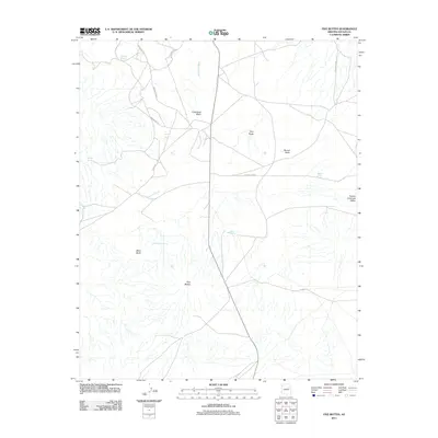
2011 Map of Five Buttes
USGS Topo · Published 2011About this map
The Five Buttes and the surrounding volcanic terrain dominate this portion of the Pueblo Colorado Valley in the Navajo Nation. This 2011 survey highlights a network of traditional and improved routes, including Tunali Rd and Indian Rte-154, which traverse a landscape defined by seasonal drainages like Bidahochi Wash and Lokasakad Wash. The importance of water in this arid environment is evident from the concentration of named water sources, such as Shonto Spring, Sand Spring, and Black Butte Spring. Prominent landmarks like Round Butte, Black Butte, and the Twin Peaks serve as significant navigational anchors for the area. The map illustrates a land where geological formations and hydraulic features dictate the placement of transportation corridors across the high desert floor.
Find a feature on this map
19 named features on this map. Tap any name to fly to it.
Don’t see what you’re looking for? This feature index may not catch every label — zoom into the map to look around manually.
Map Details
Editions of this 2011 Five Buttes Map
This is the sole edition of this map. No revisions or reprints were ever made.
Other maps of this area

1883 · Tusayan
USGS Topo · 1:250,000

1886 · Tusayan
USGS Topo · 1:250,000

1886 · Fort Defiance
USGS Topo · 1:250,000

1892 · Fort Defiance
USGS Topo · 1:250,000

1947 · Flagstaff
USGS Topo · 1:250,000

1954 · Flagstaff
USGS Topo · 1:250,000

1954 · Gallup
USGS Topo · 1:250,000

1958 · Gallup
USGS Topo · 1:250,000

1958 · Flagstaff
USGS Topo · 1:250,000

1959 · Gallup
USGS Topo · 1:250,000