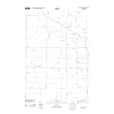
2013 Map of Five Corners
USGS Topo · Published 2013About this map
Kirchhayn and the surrounding agricultural landscapes of Ozaukee County define this portion of the Wisconsin countryside during the early 21st century. The map illustrates a transition between traditional farmsteads like Hidden Talent Farm and Cedar Lynn Farm and the emerging residential road networks branching off from historic junctions. Several named crossroads, including Decker Corner, Horns Corners, and the namesake Five Corners, serve as the primary landmarks for local navigation. The natural drainage of the region is traced by the winding Cedar Cr and Pigeon Cr, while Mud Lake sits in the northeast corner near Cedar Sauk Rd. Local history is embedded in the road names themselves, such as Kaehlers Mill Rd and Covered Bridge Rd, which reflect the area's nineteenth-century industrial and transportation heritage.
Find a feature on this map
72 named features on this map. Tap any name to fly to it.
Don’t see what you’re looking for? This feature index may not catch every label — zoom into the map to look around manually.
Map Details
Editions of this 2013 Five Corners Map
This is the sole edition of this map. No revisions or reprints were ever made.
Other maps of this area

1892 · Milwaukee
USGS Topo · 1:62,500

1892 · Waukesha
USGS Topo · 1:62,500

1892 · Port Washington
USGS Topo · 1:62,500

1901 · Milwaukee
USGS Topo · 1:62,500

1901 · Waukesha
USGS Topo · 1:62,500

1904 · West Bend
USGS Topo · 1:62,500

1904 · Port Washington
USGS Topo · 1:62,500

1906 · Waukesha
USGS Topo · 1:62,500

1906 · Milwaukee
USGS Topo · 1:62,500

1954 · Milwaukee
USGS Topo · 1:250,000