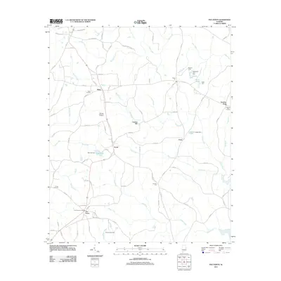
2011 Map of Five Points
USGS Topo · Published 2011About this map
Five Points and its surrounding rural communities are defined by a network of creeks and small impoundments in this 2011 survey. The landscape is dotted with family and community landmarks, such as Bethel Cemetery and Sky View Memorial Cemetery, which serve as vital touchstones for local genealogists. Named for the intersection of local roads, the area maintains its rural character with small clusters of settlement at Stroud, Welch, and Finley.
Find a feature on this map
95 named features on this map. Tap any name to fly to it.
Don’t see what you’re looking for? This feature index may not catch every label — zoom into the map to look around manually.
Map Details
Editions of this 2011 Five Points Map
This is the sole edition of this map. No revisions or reprints were ever made.
Other maps of this area

1899 · Wedowee
USGS Topo · 1:125,000

1902 · Wedowee
USGS Topo · 1:125,000

1907 · Opelika
USGS Topo · 1:125,000

1909 · Opelika
USGS Topo · 1:125,000

1953 · Atlanta
USGS Topo · 1:250,000

1955 · Phenix City
USGS Topo · 1:250,000

1957 · Phenix City
USGS Topo · 1:250,000

1957 · Atlanta
USGS Topo · 1:250,000

1958 · Phenix City
USGS Topo · 1:250,000

1958 · Atlanta
USGS Topo · 1:250,000