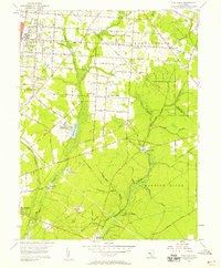
1956 Map of Five Points
USGS Topo · Published 1958About this map
The sprawling grounds of the Vineland State School and the Manantico Colony anchor the northwestern portion of this mid-century survey, illustrating the institutional footprint in Cumberland County. A transition from the industrial and civic hubs of Vineland and Millville leads into a landscape of agricultural settlements like New Italy and East Vineland. The eastern half is defined by the winding course of the Maurice River and the Manumuskin River, where the terrain is marked by numerous Gravel Pits and older industrial sites like Bennetts Mill. Transportation networks are well-defined by the Central RR of New Jersey and the Pennsylvania-Reading Seashore Lines, which supported the region's movement of goods and people between these rural communities and the larger urban centers of South Jersey.
Find a feature on this map
83 named features on this map. Tap any name to fly to it.
Don’t see what you’re looking for? This feature index may not catch every label — zoom into the map to look around manually.
Map Details
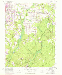
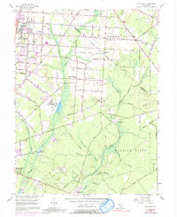
Editions of this 1956 Five Points Map
3 editions found
Other maps of this area

1890 · Hammonton
USGS Topo · 1:62,500

1890 · Tuckahoe
USGS Topo · 1:62,500

1890 · Bridgeton
USGS Topo · 1:62,500

1890 · Glassboro
USGS Topo · 1:62,500

1893 · Tuckahoe
USGS Topo · 1:62,500

1894 · Hammonton
USGS Topo · 1:62,500

1894 · Bridgeton
USGS Topo · 1:62,500

1898 · Glassboro
USGS Topo · 1:62,500

1898 · Hammonton
USGS Topo · 1:62,500

1899 · Vineland
USGS Topo · 1:125,000