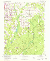
1956 Map of Five Points
USGS Topo · Published 1972About this map
The agricultural and institutional landscape of Cumberland County unfolds across this 1956 survey, updated with 1972 revisions. The western edge is dominated by the growth of Vineland, featuring the expansive grounds of the Vineland State School and the Manantico Colony. The naming of local roads—such as Italia Avenue, Palermo Avenue, and Trento Avenue—reflects the cultural heritage of the New Italy settlement and the surrounding fruit-growing region.
Find a feature on this map
47 named features on this map. Tap any name to fly to it.
Don’t see what you’re looking for? This feature index may not catch every label — zoom into the map to look around manually.
Map Details
Editions of this 1956 Five Points Map
3 editions found
Other maps of this area

1890 · Hammonton
USGS Topo · 1:62,500

1890 · Tuckahoe
USGS Topo · 1:62,500

1890 · Bridgeton
USGS Topo · 1:62,500

1890 · Glassboro
USGS Topo · 1:62,500

1893 · Tuckahoe
USGS Topo · 1:62,500

1894 · Hammonton
USGS Topo · 1:62,500

1894 · Bridgeton
USGS Topo · 1:62,500

1898 · Glassboro
USGS Topo · 1:62,500

1898 · Hammonton
USGS Topo · 1:62,500

1899 · Vineland
USGS Topo · 1:125,000