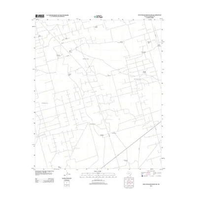
2012 Map of Five Wells Ranch NW
USGS Topo · Published 2012About this map
Bird Ranch and a dense network of ranch and oil-access roads define this pocket of the Permian Basin in Andrews County. The landscape is characterized by the coexistence of traditional cattle ranching and modern energy extraction, as evidenced by large-scale petroleum operations like the McFarland Oil Field, East Means Oil Field, and the North Magutex Oil Field. This 2012 survey illustrates how water remains vital to the land's utility, with numerous named water sources such as the Charley Nichols Windmill, Uncle John Windmill, and Howl Windmill positioned throughout the territory. The intricate web of private and county roads, including Ne 6010 and Plant Rd, connects these isolated industrial and residential points across the arid West Texas plains.
Find a feature on this map
28 named features on this map. Tap any name to fly to it.
Don’t see what you’re looking for? This feature index may not catch every label — zoom into the map to look around manually.
Map Details
Editions of this 2012 Five Wells Ranch NW Map
This is the sole edition of this map. No revisions or reprints were ever made.
Other maps of this area

1954 · Hobbs
USGS Topo · 1:250,000

1958 · Hobbs
USGS Topo · 1:250,000

1963 · Andrews
USGS Topo · 1:24,000

1970 · Cedar Point Ranch
USGS Topo · 1:24,000

1970 · Seminole SE
USGS Topo · 1:24,000

1970 · McKenzie Lake SE
USGS Topo · 1:24,000

1971 · Five Wells Ranch NW
USGS Topo · 1:24,000

1971 · Florey
USGS Topo · 1:24,000

1971 · Five Wells Ranch SE
USGS Topo · 1:24,000

1971 · Five Wells Ranch
USGS Topo · 1:24,000