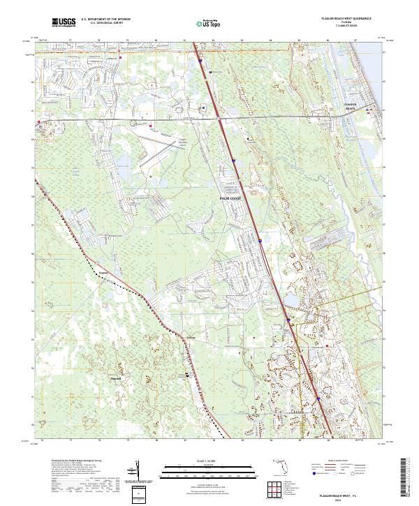
2024 Map of Flagler Beach West
USGS Topo · Published 2024About this map
Palm Coast and Bunnell anchor this modern-era study of coastal Flagler County, where residential development meets the extensive wetlands of Graham Swamp and Black Branch Swamp. The landscape is a study in planned growth, with the radial road patterns of Palm Coast contrasting with the more traditional grid of Bunnell, the county seat. Along the eastern edge, the Intracoastal Waterway runs parallel to the Atlantic, providing a vital maritime corridor near Flagler Beach. Inland, the map documents small settlements like Korona and Dupont, which retain their identity amidst the expanding suburbs. Public lands and historical sites are prominent, including the Bulow Creek State Park and several local burial grounds such as Saint Marys Cem and Strickland Memorial Cem. Transportation and infrastructure are central themes, evidenced by the Flagler Executive Airport and the network of trails like the Lehigh Greenway Trl and Florida Circumnavigational Paddling Trl.
Find a feature on this map
209 named features on this map. Tap any name to fly to it.
Don’t see what you’re looking for? This feature index may not catch every label — zoom into the map to look around manually.
Map Details
Editions of this 2024 Flagler Beach West Map
This is the sole edition of this map. No revisions or reprints were ever made.
Other maps of this area

1927 · Matanzas
USGS Topo · 1:48,000

1937 · Dinner Island
USGS Topo · 1:48,000

1937 · Ormond
USGS Topo · 1:48,000

1943 · Dinner Island
USGS Topo · 1:62,500

1943 · Matanzas
USGS Topo · 1:62,500

1944 · Ormond
USGS Topo · 1:62,500

1944 · Dinner Island
USGS Topo · 1:62,500

1944 · Matanzas
USGS Topo · 1:62,500

1954 · Daytona Beach
USGS Topo · 1:250,000

1956 · Favoretta
USGS Topo · 1:24,000