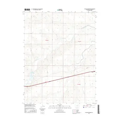
2016 Map of Flagler Reservoir
USGS Topo · Published 2016About this map
The South Fork Republican River carves a winding path through this portion of Kit Carson County, defining the drainage patterns of the high plains. In the southeast, the town of Seibert sits along the interstate corridor, representing a primary point of settlement and commerce for the surrounding ranching and farming community. The landscape is characterized by intermittent drainages such as Duck Cr and Buffalo Cr in the north, and the more prominent Sand Creek and Sand Cr to the south.
Find a feature on this map
26 named features on this map. Tap any name to fly to it.
Don’t see what you’re looking for? This feature index may not catch every label — zoom into the map to look around manually.
Map Details
Editions of this 2016 Flagler Reservoir Map
This is the sole edition of this map. No revisions or reprints were ever made.
Other maps of this area

1954 · Limon
USGS Topo · 1:250,000

1957 · Limon
USGS Topo · 1:250,000

1958 · Limon
USGS Topo · 1:250,000

1979 · Seibert NE
USGS Topo · 1:24,000

1979 · Hugo 4 NE
USGS Topo · 1:24,000

1979 · Flagler
USGS Topo · 1:24,000
1979 · Flagler NE
USGS Topo · 1:24,000

1979 · Stratton 3 NE
USGS Topo · 1:24,000
1979 · Seibert NW
USGS Topo · 1:24,000
1979 · South of Flagler Reservoir
USGS Topo · 1:24,000