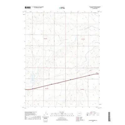
2019 Map of Flagler Reservoir
USGS Topo · Published 2019About this map
The South Fork Republican River winds through the high plains of Kit Carson County, anchoring a landscape defined by its vital watercourses and sparse settlement. On the eastern edge of the quadrangle, the town of Seibert serves as the primary community, situated along a busy transportation corridor that includes a modern expressway and its accompanying Frontage Rd. This 2019 survey documents a region where agricultural land divisions, marked by a precise grid of county roads such as Co Rd 12 and Co Rd V, contrast with the organic drainage patterns of Sand Cr and Duck Cr.
Find a feature on this map
24 named features on this map. Tap any name to fly to it.
Don’t see what you’re looking for? This feature index may not catch every label — zoom into the map to look around manually.
Map Details
Editions of this 2019 Flagler Reservoir Map
This is the sole edition of this map. No revisions or reprints were ever made.
Other maps of this area

1954 · Limon
USGS Topo · 1:250,000

1957 · Limon
USGS Topo · 1:250,000

1958 · Limon
USGS Topo · 1:250,000

1979 · Seibert NE
USGS Topo · 1:24,000

1979 · Hugo 4 NE
USGS Topo · 1:24,000

1979 · Flagler
USGS Topo · 1:24,000
1979 · Flagler NE
USGS Topo · 1:24,000

1979 · Stratton 3 NE
USGS Topo · 1:24,000
1979 · Seibert NW
USGS Topo · 1:24,000
1979 · South of Flagler Reservoir
USGS Topo · 1:24,000