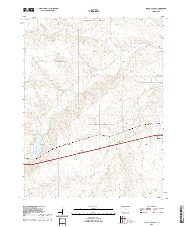
2022 Map of Flagler Reservoir
USGS Topo · Published 2022About this map
Seibert sits at the eastern edge of this landscape, where the high plains of Kit Carson County are defined by the winding course of the South Fork Republican River. This modern survey illustrates the expansive drainage systems of the region, including Duck Cr and Sand Creek, which carve through the sectional grid of rural roads. The western portion of the map is anchored by the Flagler Reservoir, a significant water feature in this semi-arid environment. The layout of county roads, such as Co RD Aa and Co RD 14, reflects the enduring Public Land Survey System structure that has governed land ownership and agricultural development here for generations. By documenting the intersection of modern infrastructure like the Frontage Rd with natural landmarks like Sand Cr, the map provides a clear record of the area's contemporary rural geography.
Find a feature on this map
24 named features on this map. Tap any name to fly to it.
Don’t see what you’re looking for? This feature index may not catch every label — zoom into the map to look around manually.
Map Details
Editions of this 2022 Flagler Reservoir Map
This is the sole edition of this map. No revisions or reprints were ever made.
Other maps of this area

1954 · Limon
USGS Topo · 1:250,000

1957 · Limon
USGS Topo · 1:250,000

1958 · Limon
USGS Topo · 1:250,000

1979 · Seibert NE
USGS Topo · 1:24,000

1979 · Hugo 4 NE
USGS Topo · 1:24,000

1979 · Flagler
USGS Topo · 1:24,000
1979 · Flagler NE
USGS Topo · 1:24,000

1979 · Stratton 3 NE
USGS Topo · 1:24,000
1979 · Seibert NW
USGS Topo · 1:24,000
1979 · South of Flagler Reservoir
USGS Topo · 1:24,000