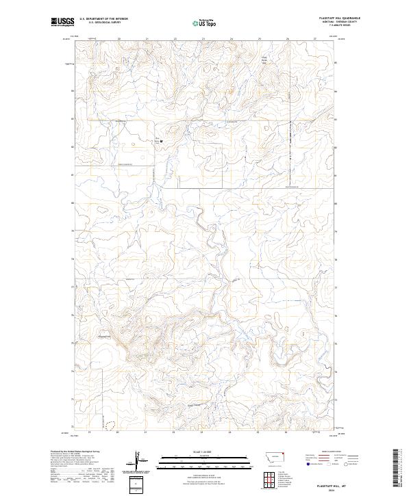
2024 Map of Flagstaff Hill
USGS Topo · Published 2024About this map
Flagstaff Hill rises as a prominent landmark in this Sheridan County landscape, where the high plains are carved by drainage systems like Green Coulee and Wolf Creek. This modern record of the region captures the essential transportation network of rural Montana, showing how Burma Trl and Rock Springs Rd navigate the undulating terrain. A singular point of genealogical interest, the Rock Spring Cem sits near the headwaters of Crazy Horse Creek, south of the distinctive Crazy Horse Gap. The map illustrates a section of the Public Land Survey System, specifically defining the interface between t33n r53e and t32n r54e. This document reflects the contemporary state of the prairie, where established ranch roads like W Reserve Rd and Green Coulee Rd connect isolated points in a landscape shaped by both natural erosion and livestock grazing history.
Find a feature on this map
14 named features on this map. Tap any name to fly to it.
Don’t see what you’re looking for? This feature index may not catch every label — zoom into the map to look around manually.
Map Details
Editions of this 2024 Flagstaff Hill Map
This is the sole edition of this map. No revisions or reprints were ever made.
Other maps of this area

1909 · Smoke Creek
USGS Topo · 1:62,500

1912 · Smoke Creek
USGS Topo · 1:62,500

1914 · Homestead
USGS Topo · 1:62,500

1947 · Homestead
USGS Topo · 1:24,000

1948 · Homestead
USGS Topo · 1:24,000

1948 · Alkali Coulee
USGS Topo · 1:24,000

1949 · Alkali Coulee
USGS Topo · 1:24,000

1950 · Shippe Canyon
USGS Topo · 1:24,000

1954 · Wolf Point
USGS Topo · 1:250,000

1958 · Wolf Point
USGS Topo · 1:250,000