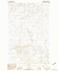
1983 Map of Flagstaff Hill
USGS Topo · Published 1983About this map
Flagstaff Hill rises as a prominent landmark in this Sheridan County landscape, where the high plains terrain is carved by the winding paths of Wolf Creek and Crazy Horse Creek. The settlement of Rock Springs provides a focal point for local history, situated near the headwaters where the topography transitions into the drainage systems of Green Creek and Green Coulee. This 1983 provisional survey captures the intersection of natural features and industrial activity, most notably at the Strip Mine located in the southern portion of the quadrangle. The map detail reflects a period of resource extraction and ranching life, preserving the specific placement of drainage gaps like Crazy Horse Gap and the intricate network of coulees that define the eastern Montana borderlands. It serves as a precise record of land use and water access in a sparsely populated region of the state.
Find a feature on this map
9 named features on this map. Tap any name to fly to it.
Don’t see what you’re looking for? This feature index may not catch every label — zoom into the map to look around manually.
Map Details
Editions of this 1983 Flagstaff Hill Map
This is the sole edition of this map. No revisions or reprints were ever made.
Other maps of this area

1909 · Smoke Creek
USGS Topo · 1:62,500

1912 · Smoke Creek
USGS Topo · 1:62,500

1914 · Homestead
USGS Topo · 1:62,500

1947 · Homestead
USGS Topo · 1:24,000

1948 · Homestead
USGS Topo · 1:24,000

1948 · Alkali Coulee
USGS Topo · 1:24,000

1949 · Alkali Coulee
USGS Topo · 1:24,000

1950 · Shippe Canyon
USGS Topo · 1:24,000

1954 · Wolf Point
USGS Topo · 1:250,000

1958 · Wolf Point
USGS Topo · 1:250,000