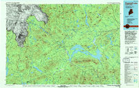
1994 Map of Flagstaff Lake
USGS Topo · Published 1994About this map
Flagstaff Lake and the high ridges of the Longfellow Mountains anchor this 1990s topographic study of the Maine-Quebec borderlands. The landscape is defined by the expansive waters of the Dead River basin and the challenging terrain of the Appalachian Trail, which traverses prominent summits such as Bigelow Mountain and Sugarloaf Mountain. This era of the Maine woods shows a mix of recreational infrastructure and remote outposts, including Big Island Camp and the historically significant Kennebago Settlement.
Find a feature on this map
189 named features on this map. Tap any name to fly to it.
Don’t see what you’re looking for? This feature index may not catch every label — zoom into the map to look around manually.
Map Details
Editions of this 1994 Flagstaff Lake Map
This is the sole edition of this map. No revisions or reprints were ever made.
Other maps of this area

1903 · Bingham
USGS Topo · 1:62,500

1904 · Anson
USGS Topo · 1:62,500

1905 · Bingham
USGS Topo · 1:62,500

1905 · The Forks
USGS Topo · 1:62,500

1907 · The Forks
USGS Topo · 1:62,500

1921 · Brassua Lake
USGS Topo · 1:62,500

1922 · Long Pond
USGS Topo · 1:62,500

1923 · Brassua Lake
USGS Topo · 1:62,500

1923 · Attean
USGS Topo · 1:62,500

1924 · Long Pond
USGS Topo · 1:62,500