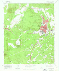
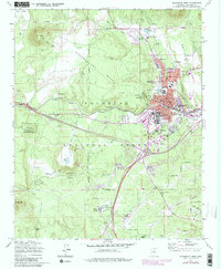
1962 Map of Flagstaff West
USGS Topo · Published 1973About this map
Observatory Mesa dominates the central landscape of this 1962 survey, serving as the high-ground host for the Lowell Observatory and the nearby Naval Observatory Reservation. The burgeoning city of Flagstaff is captured during a period of significant mid-century growth, showing the residential expansion along Pine Ave and Cedar Ave toward the base of Switzer Mesa. This era finds the Arizona State College campus integrated into the southern edge of the downtown grid, while the Atchison Topeka and Santa Fe Railroad provides the primary industrial corridor through the heart of the community.
Find a feature on this map
62 named features on this map. Tap any name to fly to it.
Don’t see what you’re looking for? This feature index may not catch every label — zoom into the map to look around manually.
Map Details
Editions of this 1962 Flagstaff West Map
5 editions found
Other maps of this area

1886 · San Francisco Mtns
USGS Topo · 1:250,000

1891 · San Francisco Mtns
USGS Topo · 1:250,000

1894 · San Francisco Mtns
USGS Topo · 1:250,000

1899 · San Francisco Mtns
USGS Topo · 1:250,000

1908 · Flagstaff
USGS Topo · 1:125,000

1912 · Flagstaff
USGS Topo · 1:125,000

1947 · Flagstaff
USGS Topo · 1:250,000

1954 · Flagstaff
USGS Topo · 1:250,000

1958 · Flagstaff
USGS Topo · 1:250,000

1960 · Flagstaff
USGS Topo · 1:250,000