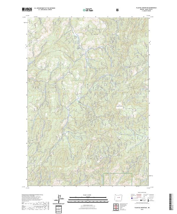
2023 Map of Flagtail Mountain
USGS Topo · Published 2023About this map
Malheur National Forest encompasses the high country of Grant County shown here, a landscape defined by prominent peaks and a dense network of mountain springs. Flagtail Mtn, Horse Mtn, and the Blue Ridge dominate the topography, providing the headwaters for numerous drainage systems including the South Fork Murderers Creek and North Fork Deer Creek. These waterways, along with family-named features like John Young Meadows, suggest a history of seasonal grazing and timber management in the Blue Mountains.
Find a feature on this map
41 named features on this map. Tap any name to fly to it.
Don’t see what you’re looking for? This feature index may not catch every label — zoom into the map to look around manually.
Map Details
Editions of this 2023 Flagtail Mountain Map
This is the sole edition of this map. No revisions or reprints were ever made.
Other maps of this area

1940 · Mount Vernon
USGS Topo · 1:62,500

1940 · Aldrich Mtn.
USGS Topo · 1:62,500

1943 · Aldrich Mtn.
USGS Topo · 1:62,500

1943 · Mount Vernon
USGS Topo · 1:62,500

1955 · Canyon City
USGS Topo · 1:250,000

1959 · Canyon City
USGS Topo · 1:250,000

1961 · Logdell
USGS Topo · 1:62,500

1961 · Izee
USGS Topo · 1:62,500

1972 · Big Weasel Sprs
USGS Topo · 1:24,000
1972 · Mc Clellan Mtn
USGS Topo · 1:24,000