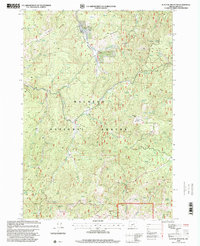
1998 Map of Flagtail Mountain
USGS Topo · Published 2000About this map
Malheur National Forest encompasses this high-elevation landscape in Grant County, defined by a series of prominent peaks and the deep drainage of Murderers Creek. The 1998 revision by the Forest Service highlights a terrain characterized by natural springs and timbered ridges, with Flagtail Mountain serving as a central landmark complete with a summit Lookout. The map provides a detailed view of the water resources essential for forestry and ranching in the region, including Blue Ridge Spring, 30-30 Spring, and Softwater Spring.
Find a feature on this map
26 named features on this map. Tap any name to fly to it.
Don’t see what you’re looking for? This feature index may not catch every label — zoom into the map to look around manually.
Map Details
Editions of this 1998 Flagtail Mountain Map
This is the sole edition of this map. No revisions or reprints were ever made.
Other maps of this area

1940 · Mount Vernon
USGS Topo · 1:62,500

1940 · Aldrich Mtn.
USGS Topo · 1:62,500

1943 · Aldrich Mtn.
USGS Topo · 1:62,500

1943 · Mount Vernon
USGS Topo · 1:62,500

1955 · Canyon City
USGS Topo · 1:250,000

1959 · Canyon City
USGS Topo · 1:250,000

1961 · Logdell
USGS Topo · 1:62,500

1961 · Izee
USGS Topo · 1:62,500

1972 · Big Weasel Sprs
USGS Topo · 1:24,000
1972 · Mc Clellan Mtn
USGS Topo · 1:24,000