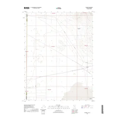
2018 Map of Flanigan
USGS Topo · Published 2018About this map
Flanigan sits at a geographic crossroads in the high desert, where the eastern slopes of the Smoke Creek Mountains meet the northern reaches of the Honey Lake Valley. This landscape is defined by the sharp transition between the mountain range and the basin floor, where the California-Nevada state line marks the western edge of the territory. The map illustrates a sparse network of essential desert corridors, including High Rock Rd and Flanigan Rd, which follow the natural contours of the valley. A collection of localized routes like Rainbow Rd and Calveda Way suggest small clusters of activity or property divisions within the wider valley floor. The survey detail reflects the expansive, open character of this border region, emphasizing the relationship between high-elevation terrain and the surrounding arid plains.
Find a feature on this map
19 named features on this map. Tap any name to fly to it.
Don’t see what you’re looking for? This feature index may not catch every label — zoom into the map to look around manually.
Map Details
Editions of this 2018 Flanigan Map
This is the sole edition of this map. No revisions or reprints were ever made.
Other maps of this area

1886 · Honey Lake
USGS Topo · 1:250,000

1886 · Granite Range
USGS Topo · 1:250,000

1891 · Honey Lake
USGS Topo · 1:250,000

1893 · Honey Lake
USGS Topo · 1:250,000

1894 · Granite Range
USGS Topo · 1:250,000

1954 · Wendel
USGS Topo · 1:62,500

1954 · Doyle
USGS Topo · 1:62,500

1955 · Westwood
USGS Topo · 1:250,000

1955 · Lovelock
USGS Topo · 1:250,000

1958 · Westwood
USGS Topo · 1:250,000