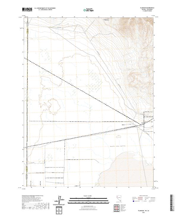
2021 Map of Flanigan
USGS Topo · Published 2021About this map
Honey Lake Valley occupies the southern portion of this high-desert basin, where the arid landscape transitions toward the Smoke Creek Mountains in the northeast. The small settlement of Flanigan serves as the primary focal point of the area, situated at the junction of Flanigan Rd and High Rock Rd. This interior basin topography is defined by its wide, flat valley floors and sparse road network, characteristic of the remote borderlands between Nevada and California.
Find a feature on this map
19 named features on this map. Tap any name to fly to it.
Don’t see what you’re looking for? This feature index may not catch every label — zoom into the map to look around manually.
Map Details
Editions of this 2021 Flanigan Map
This is the sole edition of this map. No revisions or reprints were ever made.
Other maps of this area

1886 · Honey Lake
USGS Topo · 1:250,000

1886 · Granite Range
USGS Topo · 1:250,000

1891 · Honey Lake
USGS Topo · 1:250,000

1893 · Honey Lake
USGS Topo · 1:250,000

1894 · Granite Range
USGS Topo · 1:250,000

1954 · Wendel
USGS Topo · 1:62,500

1954 · Doyle
USGS Topo · 1:62,500

1955 · Westwood
USGS Topo · 1:250,000

1955 · Lovelock
USGS Topo · 1:250,000

1958 · Westwood
USGS Topo · 1:250,000