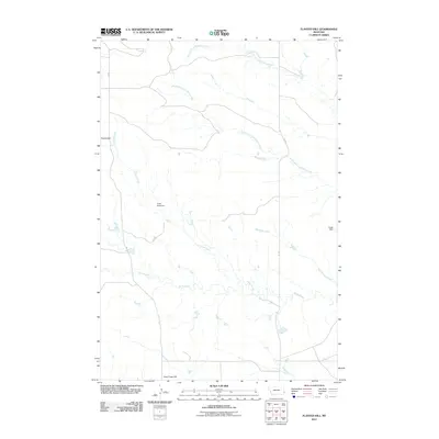
2011 Map of Flasted Hill
USGS Topo · Published 2011About this map
Flasted Hill and Coal Creek Hill rise above a landscape defined by an intricate network of seasonal drainage in this section of Fallon County. The area is marked by the convergence of several waterways, including Flasted Creek, Horse Creek, and the many branches of Coal Bank Creek. Agricultural land management in this semi-arid environment is evidenced by water infrastructure such as Sand Rock Dam and Logar Dam, which serve to capture runoff for local use. While the topography is varied, human presence is sparse, represented primarily by the lone 101 RD crossing the eastern half of the quadrangle. This map provides a detailed view of the natural water distribution patterns that have dictated land use and ranching boundaries in this part of eastern Montana.
Find a feature on this map
10 named features on this map. Tap any name to fly to it.
Don’t see what you’re looking for? This feature index may not catch every label — zoom into the map to look around manually.
Map Details
Editions of this 2011 Flasted Hill Map
This is the sole edition of this map. No revisions or reprints were ever made.
Other maps of this area

1953 · Miles City
USGS Topo · 1:250,000

1954 · Ekalaka
USGS Topo · 1:250,000

1956 · Ekalaka
USGS Topo · 1:250,000

1957 · Miles City
USGS Topo · 1:250,000

1958 · Miles City
USGS Topo · 1:250,000

1958 · Ekalaka
USGS Topo · 1:250,000

1965 · Ekalaka
USGS Topo · 1:250,000

1980 · Dutchmans Hill
USGS Topo · 1:24,000
1980 · Lampkin Gulch
USGS Topo · 1:24,000
1980 · Humbolt Hills
USGS Topo · 1:24,000