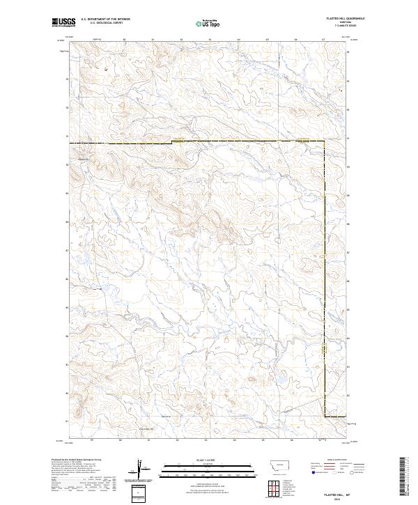
2024 Map of Flasted Hill
USGS Topo · Published 2024About this map
Flasted Hill and Coal Creek Hill anchor this corner of the High Plains, where the border between Fallon and Carter counties intersects a complex drainage system. The terrain is defined by the winding paths of Flasted Creek and the southern reaches of North Fork Coal Bank Creek, showing a landscape shaped by intermittent water flow and open rangeland. Rural infrastructure is concentrated along a handful of established routes, including Webster Rd and Chimney Creek Rd, which provide the primary access to this sparsely settled cattle country. The map illustrates the traditional Public Land Survey System grid across six townships, including t2n r60e and t2n r61e, reflecting the enduring land divisions of the American West. Topographic details trace the subtle draws and ridges leading toward Squabble Creek and Horse Creek, essential landmarks for local ranching and navigation.
Find a feature on this map
18 named features on this map. Tap any name to fly to it.
Don’t see what you’re looking for? This feature index may not catch every label — zoom into the map to look around manually.
Map Details
Editions of this 2024 Flasted Hill Map
This is the sole edition of this map. No revisions or reprints were ever made.
Other maps of this area

1953 · Miles City
USGS Topo · 1:250,000

1954 · Ekalaka
USGS Topo · 1:250,000

1956 · Ekalaka
USGS Topo · 1:250,000

1957 · Miles City
USGS Topo · 1:250,000

1958 · Miles City
USGS Topo · 1:250,000

1958 · Ekalaka
USGS Topo · 1:250,000

1965 · Ekalaka
USGS Topo · 1:250,000

1980 · Dutchmans Hill
USGS Topo · 1:24,000
1980 · Lampkin Gulch
USGS Topo · 1:24,000
1980 · Humbolt Hills
USGS Topo · 1:24,000