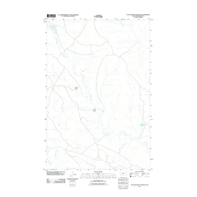
2011 Map of Flat Bottom Coulee SE
USGS Topo · Published 2011About this map
Stellar Creek defines the drainage of this Rosebud County landscape, winding south towards its confluence with North Prong Hay Creek. The terrain is characterized by the namesake Flat Bottom Coulee, a distinct topographic depression that highlights the arid ranching geography of eastern Montana. Water management is a central theme of this 2011 survey, with infrastructure such as the Gearhart Number 4 Dam and Absolen Reservoir located in the eastern portion of the sheet. These features, along with Lining Ash Creek and Rattlesnake Creek, illustrate the historical and ongoing efforts to capture seasonal runoff in a region where water rights and access are vital to the local economy and land use patterns.
Find a feature on this map
7 named features on this map. Tap any name to fly to it.
Don’t see what you’re looking for? This feature index may not catch every label — zoom into the map to look around manually.
Map Details
Editions of this 2011 Flat Bottom Coulee SE Map
This is the sole edition of this map. No revisions or reprints were ever made.
Other maps of this area

1954 · Forsyth
USGS Topo · 1:250,000

1957 · Forsyth
USGS Topo · 1:250,000

1958 · Forsyth
USGS Topo · 1:250,000

1968 · Donleys Reservoir
USGS Topo · 1:24,000

1968 · Finch NE
USGS Topo · 1:24,000

1968 · Black Coulee
USGS Topo · 1:24,000

1969 · Rudie Coulee
USGS Topo · 1:24,000

1969 · Flat Bottom Coulee SW
USGS Topo · 1:24,000

1969 · Flat Bottom Coulee NE
USGS Topo · 1:24,000
1969 · Rough Creek SW
USGS Topo · 1:24,000